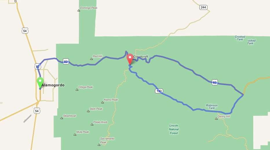
Alamogordo to Lincoln National Forest - New Mexico
Distance: 59.4 Miles Duration: 1 Hour, 22 Minutes
Data, imagery and map information provided by MapQuest, Open Street Map and contributors, CC-BY-SA,.
This is a loop route that goes around an area of the Lincoln National Forest.
This is a loop route that goes around an area of the Lincoln National Forest.
|
1. Head north on 54 / 70 N White Sands Blvd
2. Turn right onto US-82E 3. Turn right onto NM-130/Cox Canyon Hwy. Continue to follow NM-130 4. Head southwest on NM-130/Rio Penasco Rd toward Curtis Canyon Rd 5. Head northwest on NM-130/Cox Canyon Hwy toward Lakeview Dr 6. Keep left at the fork 7. End Route You can turn Left and head West on US-82 to get back to Alamogordo. |
3.0 Miles
34.7 Miles 1.7 Miles 13.4 Miles 4.4 Miles 2.2 Miles |
Other Cities or Towns that this Route passes through:
Cloudcroft, NM
Directions from scenicdriver.com are only to be used for planning purposes. It is possible that traffic, weather, construction projects or other events may cause conditions to differ from the directions listed and the map image shown, please plan your route accordingly. All signs or notices regarding your route must be obeyed.
