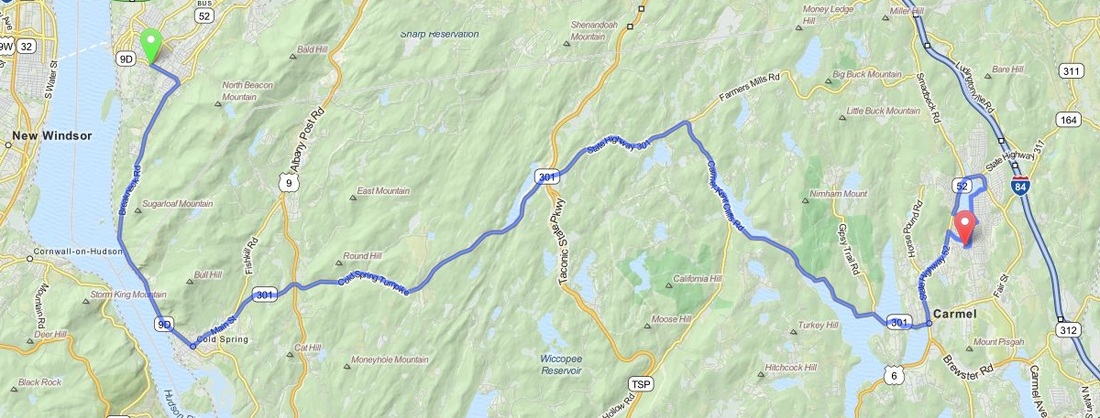
Beacon to Lake Carmel - New York
Distance: 31.3 Miles Duration: 53 Minutes
Data, imagery and map information provided by MapQuest, Open Street Map and contributors, CC-BY-SA,.
Description
The Beacon to Lake Carmel drive takes you by the Hudson River, the Hudson Highlands and cuts through Clarence Fahnestock Memorial State Park. Shortly after you start your trek you can see the Hudson River on your right and some fantastic mountain ranges on your left including the cliffs of Breakneck Ridge.
About half way through the drive you'll see a great view of Canopus Lake on your left. Next up you'll encounter Boyd Corners reservoir followed by a spectacular view of the West Branch Reservoir. As you drive across the bridge over West Branch you can take in stunning views of the reservoir on both sides. The drive ends with you going up the West side of Lake Carmel, crossing the bridge near the top of the lake and then coming down the East side.
About half way through the drive you'll see a great view of Canopus Lake on your left. Next up you'll encounter Boyd Corners reservoir followed by a spectacular view of the West Branch Reservoir. As you drive across the bridge over West Branch you can take in stunning views of the reservoir on both sides. The drive ends with you going up the West side of Lake Carmel, crossing the bridge near the top of the lake and then coming down the East side.
Directions
Starting Point: Intersection of Wolcott Ave and Teller Ave
1. Head east on Wolcott Ave
1.5 Miles
2. Continue onto New York 9D S/Breakneck Rd
5.1 Miles
3. Turn left onto NY-301 E/Main St
17.5 Miles
4. Turn right onto County Rd 47/NY-301 E/Carmel-Kent Cliffs Rd
1.3 Miles
5. Turn left onto NY-52 W/Gleneida Ave
2.0 Miles
6. Turn right onto W Lakeshore Dr
0.9 Miles
7. Turn left onto Grey Oaks Ct
125 Feet
8. Sharp right onto Snadbeck Ave
0.6 Miles
9. Slight right onto NY-311 N
0.3 Miles
10. Slight right onto County Rd 46/Terry Hill Rd
0.3 Miles
11. Take the 1st right onto Lakeshore Dr E
1.0 Miles
12. Take the 1st right to stay on Lakeshore Dr E
0.5 Miles
13. Take the 1st right onto Lakeshore Rd S
479 Feet
End Route
Other Cities or Towns that this Route passes through:
Cold Spring, NY
Carmel, NY
Cold Spring, NY
Carmel, NY
Directions from scenicdriver.com are only to be used for planning purposes. It is possible that traffic, weather, construction projects or other events may cause conditions to differ from the directions listed and the map image shown, please plan your route accordingly. All signs or notices regarding your route must be obeyed.
