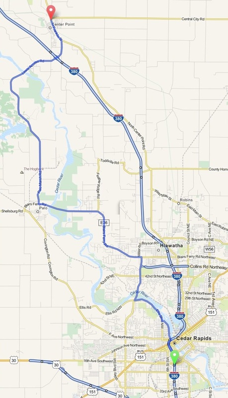
Cedar Rapids to Center Point - Iowa
Distance: 23 Miles Duration: 47 Minutes
Data, imagery and map information provided by MapQuest, Open Street Map and contributors, CC-BY-SA,.
|
1. Head north on I-380 N
2. Take exit 19C for 1st St W 3. Turn right onto 1st St NW 4. Make a U-turn at A Ave NW 5. 1st St NW turns slightly left and becomes Penn Ave NW 6. Turn right onto Ellis Blvd NW 7. Turn right onto Edgewood Rd NW 8. Turn left onto N River Blvd NE 9. Turn right onto Ushers Ferry Rd 10. Turn left onto Blairs Ferry Rd NE/Co Trunk Rd E36 11. Turn right onto Palo Marsh Rd 12. Continue onto Lewis Bottoms Rd 13. Continue onto Palo Marsh Rd 14. Continue straight onto Lewis Bottoms Rd 15. Continue onto Lewis Access Rd 16. Continue onto Lewis Bottoms Rd 17. Continue straight onto Lewis Access Rd 18. Continue onto Franklin St 19. End Route |
0.7 Miles
0.2 Miles 285 Feet 1.0 Miles 492 Feet 1.8 Miles 1.5 Miles 0.6 Miles 0.4 Miles 5.9 Miles 3.1 Miles 0.9 Miles 0.6 Miles 1.0 Miles 0.4 Miles 0.4 Miles 3.4 Miles 0.6 Miles |
Other Cities or Towns that this Route passes through:
Manhattan / Robbins Lake Park
Palo Marsh Co Park
Pleasant Creek State Park
Manhattan / Robbins Lake Park
Palo Marsh Co Park
Pleasant Creek State Park
Directions from scenicdriver.com are only to be used for planning purposes. It is possible that traffic, weather, construction projects or other events may cause conditions to differ from the directions listed and the map image shown, please plan your route accordingly. All signs or notices regarding your route must be obeyed.
