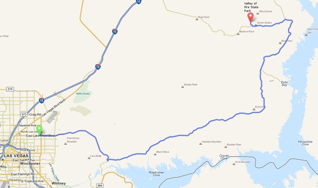
North Las Vegas to Valley of Fire State Park
Distance: 57.8 Miles Duration: 1 Hour 11 Minutes
Data, imagery and map information provided by MapQuest, Open Street Map and contributors, CC-BY-SA,.

Directions
Please note that this route has tolls.
1. Head east on NV-147 E/E Lake Mead Blvd (Partial Toll Road)
9.4 Miles
2. Turn left onto Northshore Road
41.7 Miles
3. Continue onto NV-167
1.1 Miles
4. Turn left onto Valley of Fire Hwy
5.3 Miles
5. Turn Right
0.1 Miles
6. Slight Left
0.1 Miles
7. Take the 2nd right
147 Feet
End Route
1. Head east on NV-147 E/E Lake Mead Blvd (Partial Toll Road)
9.4 Miles
2. Turn left onto Northshore Road
41.7 Miles
3. Continue onto NV-167
1.1 Miles
4. Turn left onto Valley of Fire Hwy
5.3 Miles
5. Turn Right
0.1 Miles
6. Slight Left
0.1 Miles
7. Take the 2nd right
147 Feet
End Route
Other Cities or Towns that this Route passes through:
Overton, NV
Echo Bay, NV
Overton, NV
Echo Bay, NV
Directions from scenicdriver.com are only to be used for planning purposes. It is possible that traffic, weather, construction projects or other events may cause conditions to differ from the directions listed and the map image shown, please plan your route accordingly. All signs or notices regarding your route must be obeyed.
