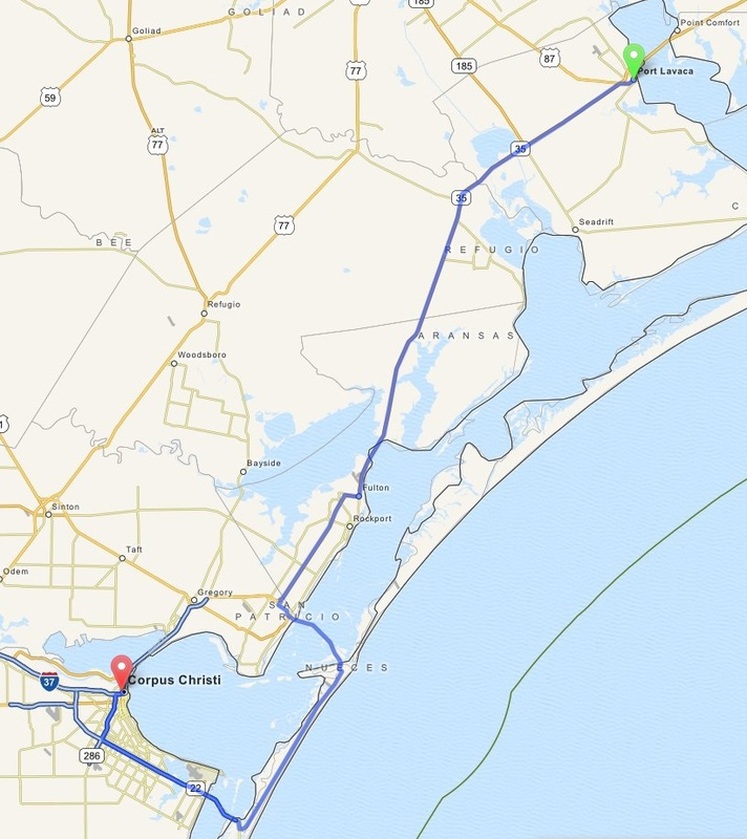
Port Lavaca to Corpus Christi
Distance: 110 Miles Duration: 2 Hours 46 Minutes
Data, imagery and map information provided by MapQuest, Open Street Map and contributors, CC-BY-SA,.
|
1. Head southwest onto US 87
2. Turn slight left onto TX 35 3. Turn right onto TX 35;FM 3036 4. Continue onto TX 35; FM 3036 5. Turn left onto TX 35 6. Turn left onto Oak Lane 7. Turn right onto North Avenue A0 8. Turn left onto TX 35L Business 9. Continue onto Loop 90 10. Continue onto TX 361 11. Turn right onto Park 22 12. Continue onto TX 358 13. Continue 14. Continue onto TX 286 15. Continue 16. Continue onto I 37 17. Continue 18. Turn slight right onto Buffalo Street 19. Turn sharp left onto North Carancahua Street 20. Turn right onto Padre Street 21. Turn left onto West Broadway Street 22. End Route |
1.42 Miles
47.3 Miles 0.23 Miles 1.11 Miles 11.4 Miles 0.16 Miles 0.43 Miles 0.91 Miles 0.60 Miles 25.2 Miles 6.07 Miles 9.23 Miles 0.81 Miles 3.67 Miles 0.27 Miles 0.22 Miles 0.20 Miles 0.19 Miles 0.17 Miles 322 Feet 0.11 Miles |
Other Cities or Towns that this Route passes through:
Fulton, TX
Rockport, TX
Fulton, TX
Rockport, TX
Directions from scenicdriver.com are only to be used for planning purposes. It is possible that traffic, weather, construction projects or other events may cause conditions to differ from the directions listed and the map image shown, please plan your route accordingly. All signs or notices regarding your route must be obeyed.
