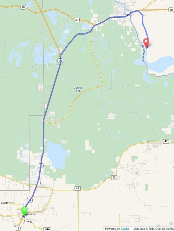
Umatilla to Saint George State Forest
Distance: 24.7 Miles Duration: 39 Minutes
Data, imagery and map information provided by MapQuest, Open Street Map and contributors, CC-BY-SA,.
Directions
Starting Point: Intersection of HWY FL-19 and Ocala St
1. Take the FL-19 North
13.4 Miles
2. Turn right onto County Road 445A
4.1 Miles
3. Turn right onto FL-40 E
3.7 Miles
4. Turn right onto St. Johns River Road
3.4 Miles
5. St. Johns River Road ends at the Bluffton Recreation Area of Saint George State Forest.
End Route
1. Take the FL-19 North
13.4 Miles
2. Turn right onto County Road 445A
4.1 Miles
3. Turn right onto FL-40 E
3.7 Miles
4. Turn right onto St. Johns River Road
3.4 Miles
5. St. Johns River Road ends at the Bluffton Recreation Area of Saint George State Forest.
End Route
Other Cities or Towns that this Route passes through:
Astor, FL
Directions from scenicdriver.com are only to be used for planning purposes. It is possible that traffic, weather, construction projects or other events may cause conditions to differ from the directions listed and the map image shown, please plan your route accordingly. All signs or notices regarding your route must be obeyed.
